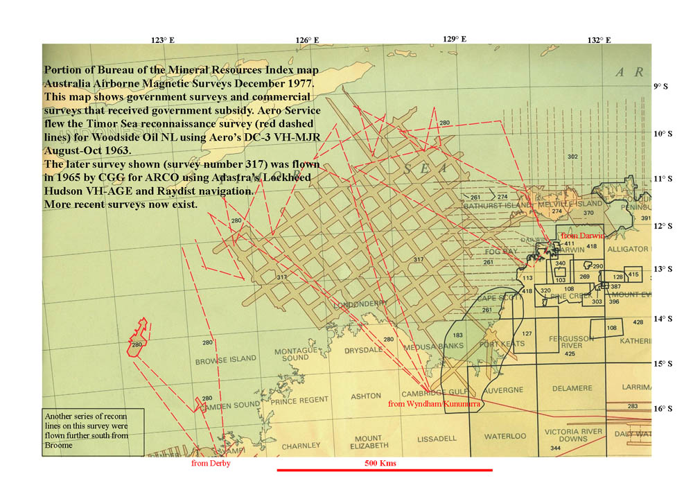
THE
BONAPARTE GULF / TIMOR SEA SURVEYS OF 1963 & 1965
The
red dashes represent lines flown by Aero Service DC-3 VH-MJR in 1963.
The area marked as 317 was flown by Adastra Hudson VH-AGE in 1965.
Area 317 was flown as a grid survey shown on the map as shaded bands
of parallel traverses separated by gaps. It
is believed that these surveys were the first Australian use of the
cesium vapour magnetometer. Both surveys used a towed bird (winch
bird).
The dashed lines offshore north of Melville Island labelled with BMR
project number '302'
represent the Arafura Sea aeromagnetic survey flown by Hunting's DC-3
G-AMYW commencing in July 1965. The contract
had been let to Adastra Hunting Geophysics Pty Limited by Shell Development
(Aust) Pty Ltd. It is believed that it was flown utilising the Raydist
navigation system set up by Adastra personnel. The area extended off
the edge of this section of map covering the Arafura Sea as far east
as Gove and the NW corner of Gulf of Carpentaria. The reason this
survey features on this old BMR index map is because it was 30% subsidised
by the government.
Source:
Bureau of Mineral Resources